ABC Automotive (UK) Ltd. – Sales Network Reports
Using the Microsoft Access “demo” database, described here, I have created a number of reports using Microsoft Power BI focusing on the Dealer network of the Financial Services Division of a fictitious company, ABC Automotive (UK) Ltd.
Click HERE to view the interactive reports in a new browser tab.
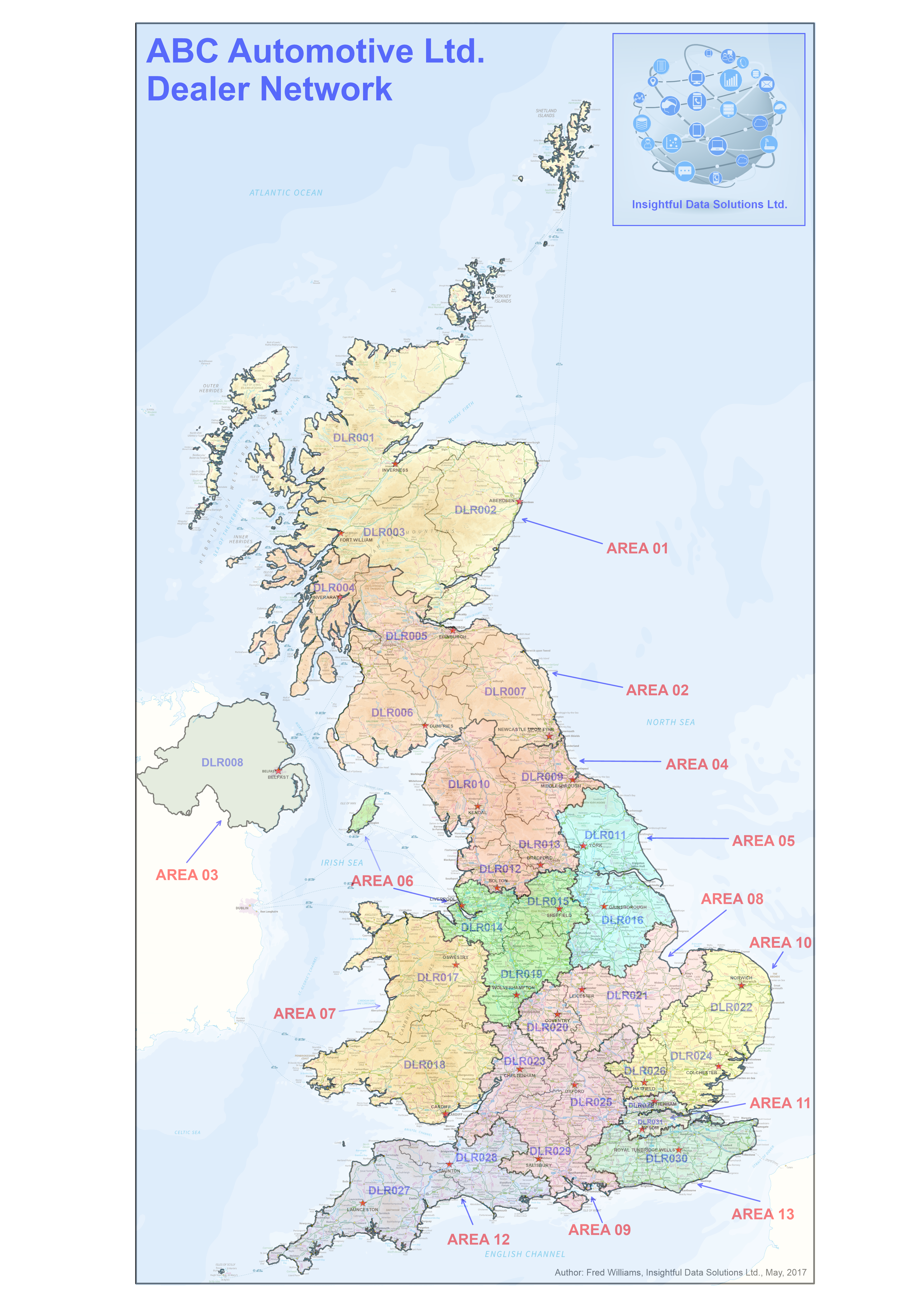
Image 1: Dealer Network Map for ABC Automotive (UK) Ltd. created using MapViewer 8 .
The primary focus of these reports is to demonstrate how a Sales Network can be fully integrated into the reporting for any company providing business insights that are based on geographic areas.
This Sales Network that has been created for ABC Automotive (UK) Ltd. is based on the common standard for the Automotive Sector in the UK (Regions / Areas / Dealers).
In addition there are maps showing UK Postcode Districts as it is also common for the Dealer areas to be defined on a Postcode District basis. This has been done for the sales network of ABC Automotive (UK) Ltd.
All of the map visualisations that are seen on the various reports have been created using the GIS software, MapViewer 8. This software is used to produce the “custom network maps” in the “ESRI Shapefile” format that will then be converted into “TopoJSON” formatted files.
These “TopoJSON” files can then be imported into Microsoft Power BI using the “Shape Map” visualisation and linked to data sources that contain the relevant geographic reference data.
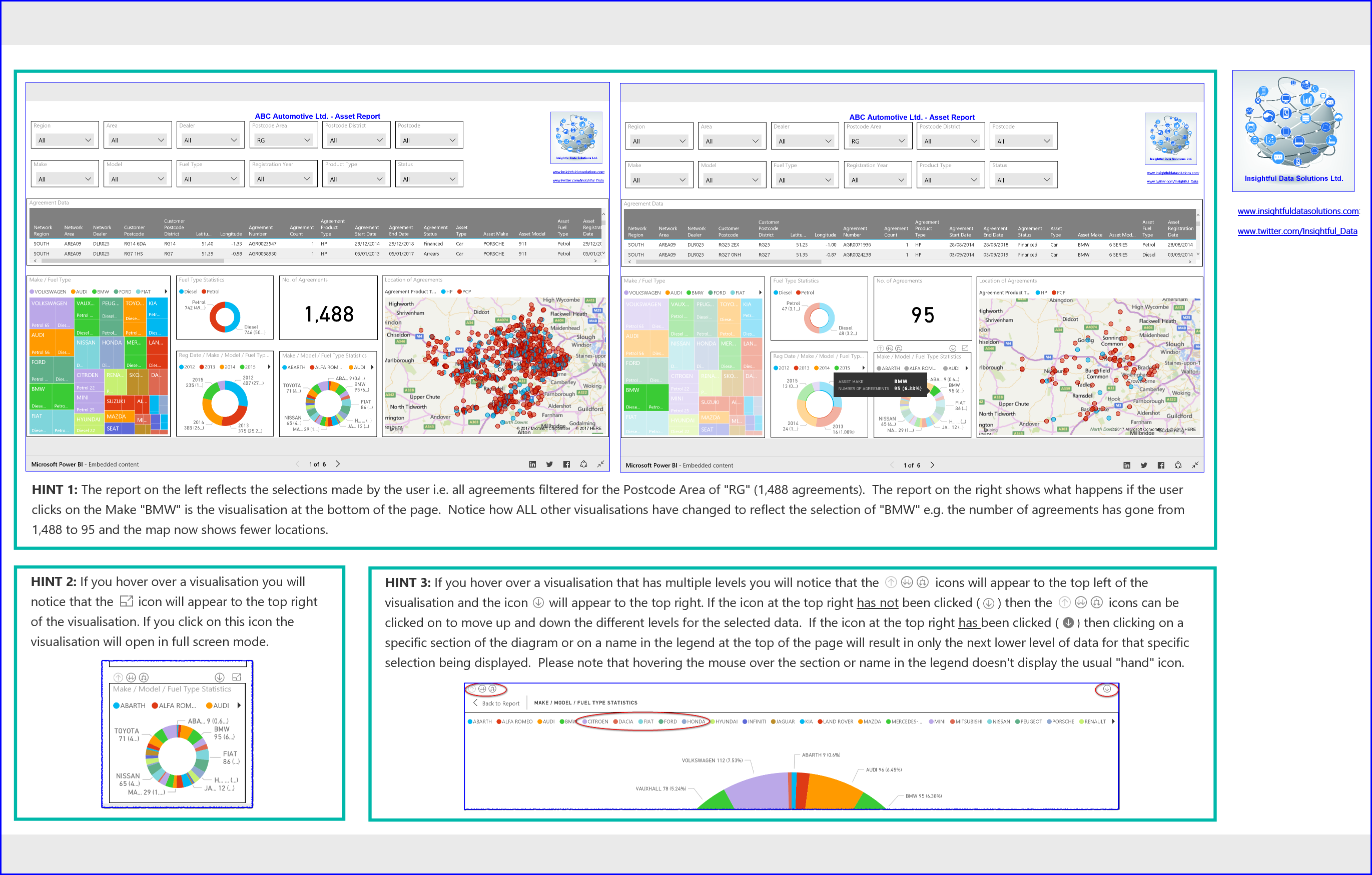
Hints: Three hints on how to select the display of information within the visualisations i.e. in addition to using the filters/slicers at the top of the page.
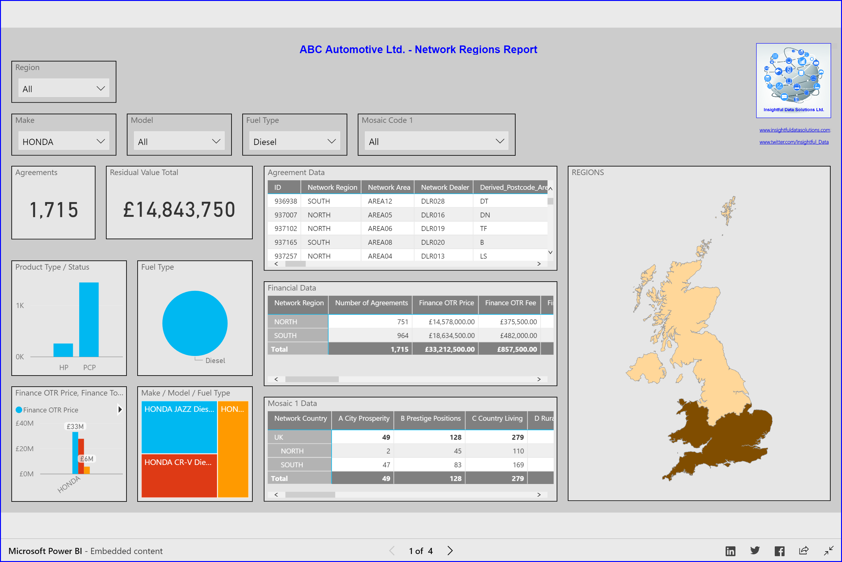
Image 2: A Network Regions report containing a number of different visualisations including a map showing the relative number of agreements within the geographical areas of the 2 Sales regions for ABC Automotive (UK) Ltd., “North” and “South”.
Of particular interest are the two matrix table visualisations that link Experian Mosaic data to agreements data and displays this information on the custom map.
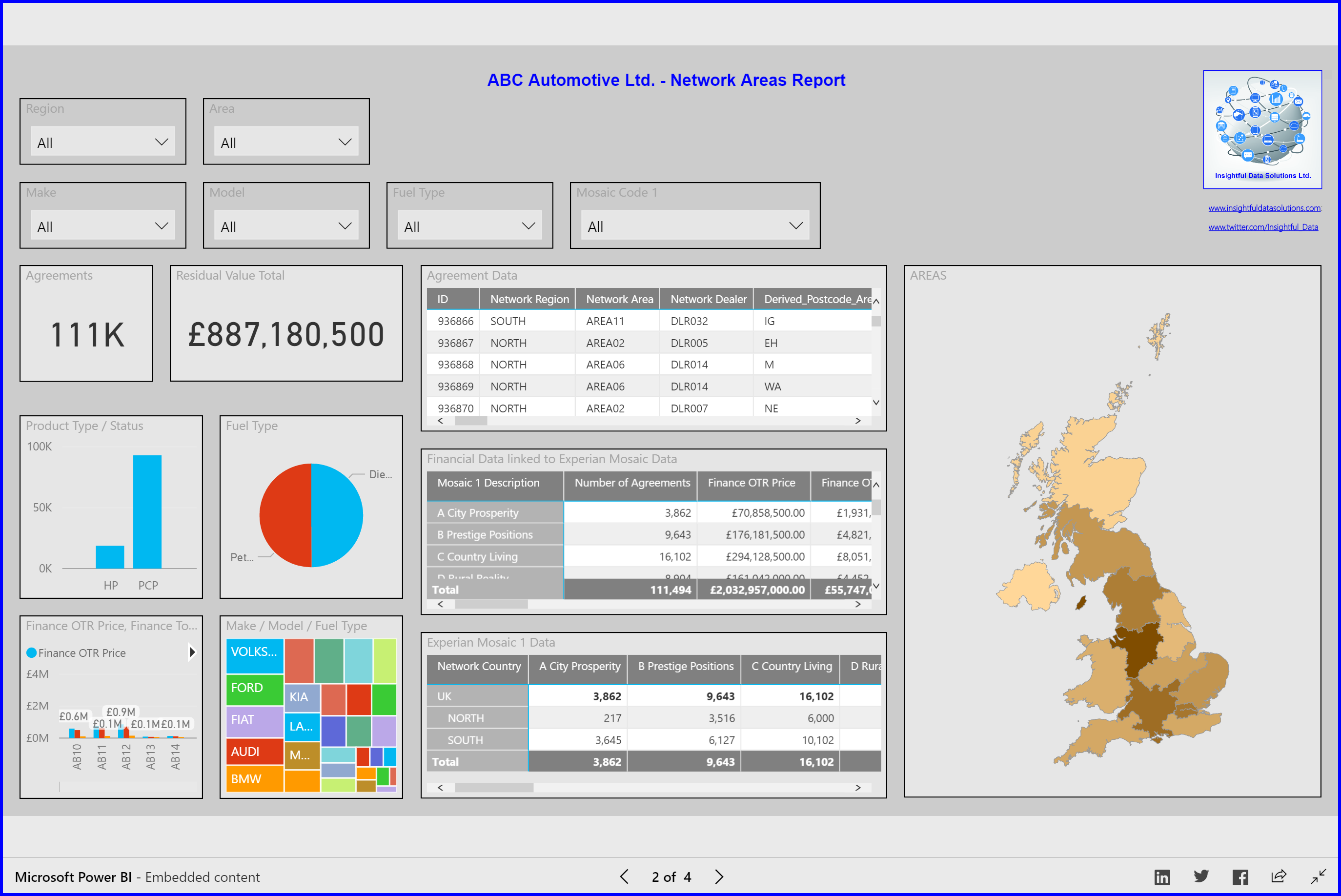
Image 3: A Network Areas report containing a number of different visualisations including a map showing the relative number of agreements within the geographical areas of the 13 Sales areas for ABC Automotive (UK) Ltd., “AREA01” to “AREA13”.
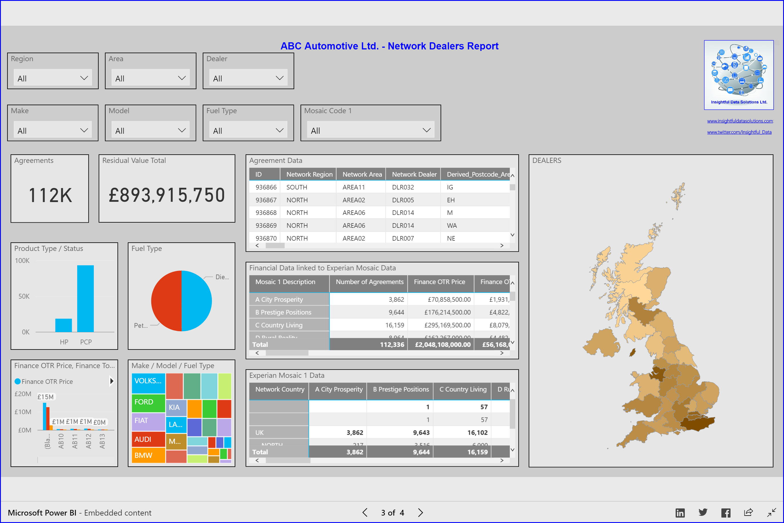
Image 4: A Network Dealer Areas report containing a number of different visualisations including a map showing the relative number of agreements within the geographical areas of the 32 Sales Dealer Areas for ABC Automotive (UK) Ltd., “DLR001” to “DLR032”.
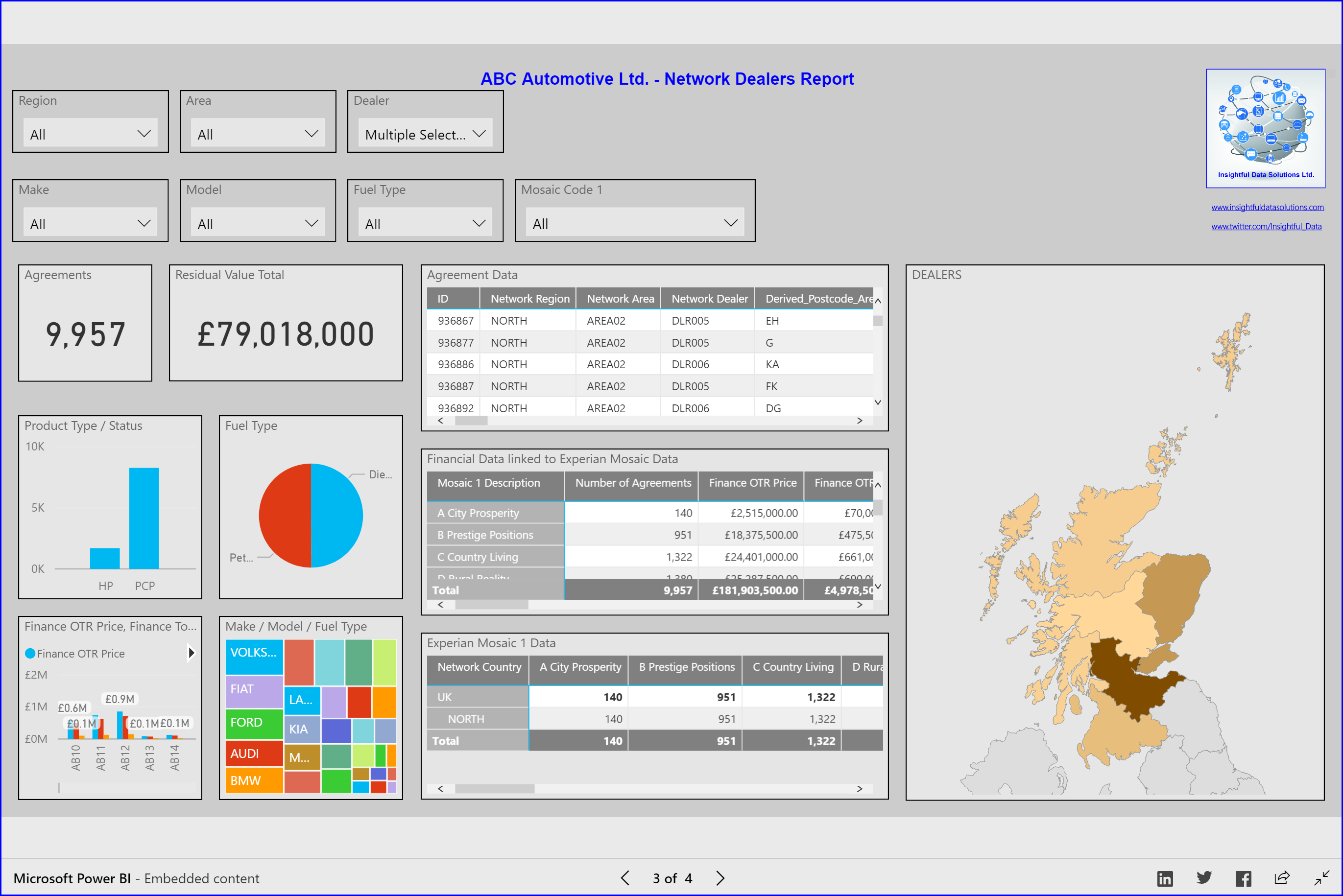
Image 5: A Network Dealer Areas report containing a number of different visualisations including a map showing the relative number of agreements within the geographical areas of the selected Sales Dealer Areas for ABC Automotive (UK) Ltd., “DLR001” to “DLR006”.
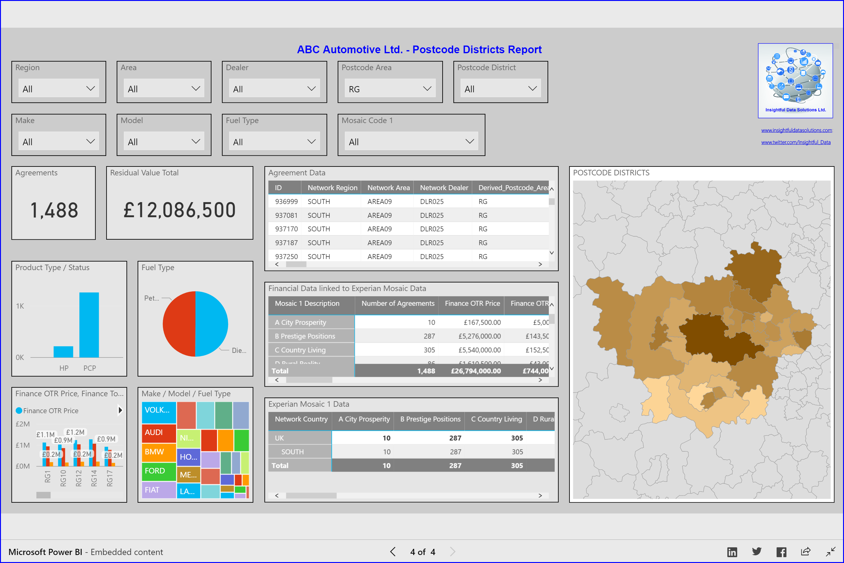
Image 6: A Postcode District report containing a number of different visualisations including a map showing, in this particular report, the relative number of agreements for the Royal Mail Postcode District geographical areas for the selected Postcode Area, “RG” for Reading, UK.
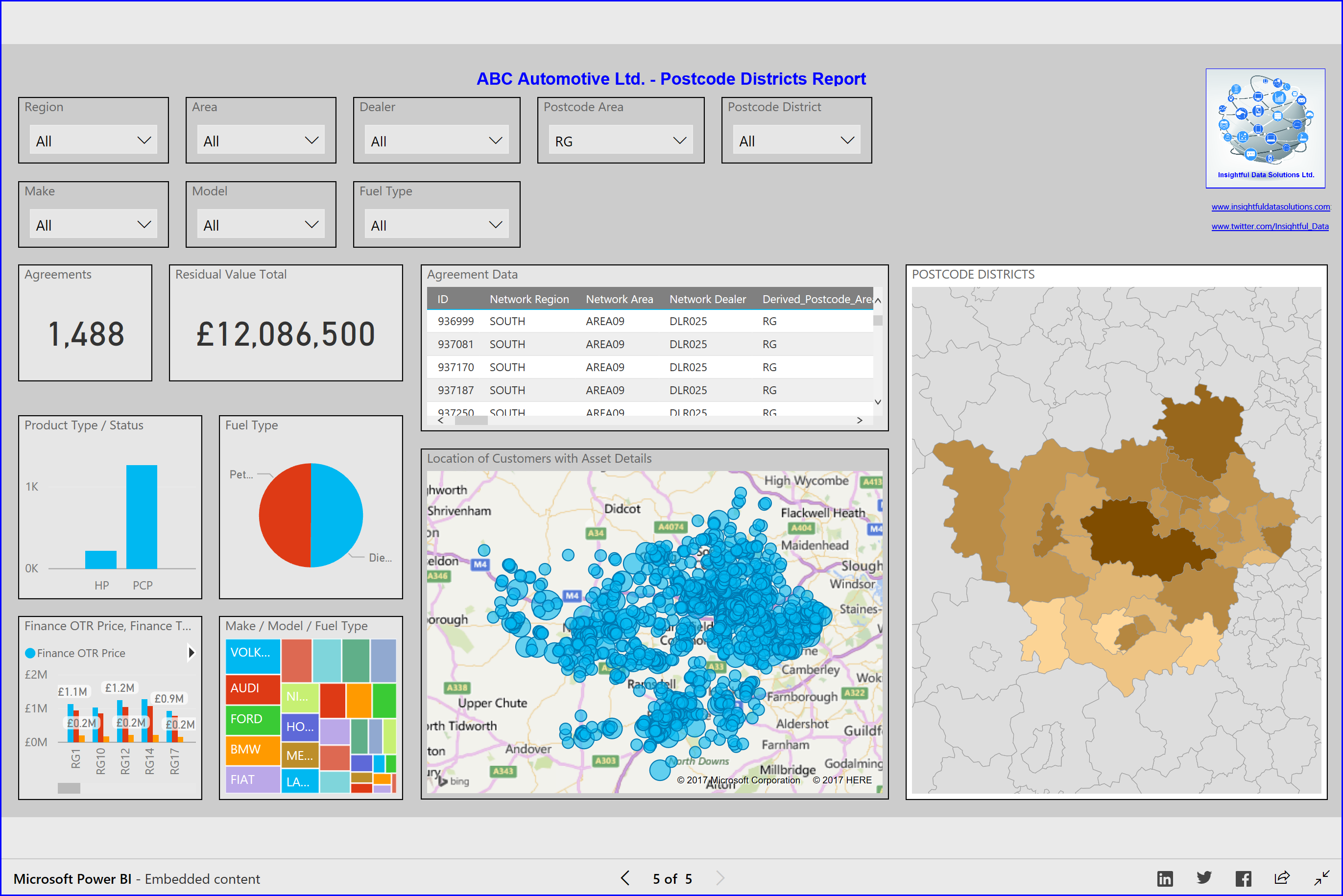
Image 7: Another Postcode District report containing a number of different visualisations including two different map visualisations showing, in this particular report, the relative number of agreements for the Royal Mail Postcode District geographical areas for the selected Postcode Area, “RG” for Reading, UK.
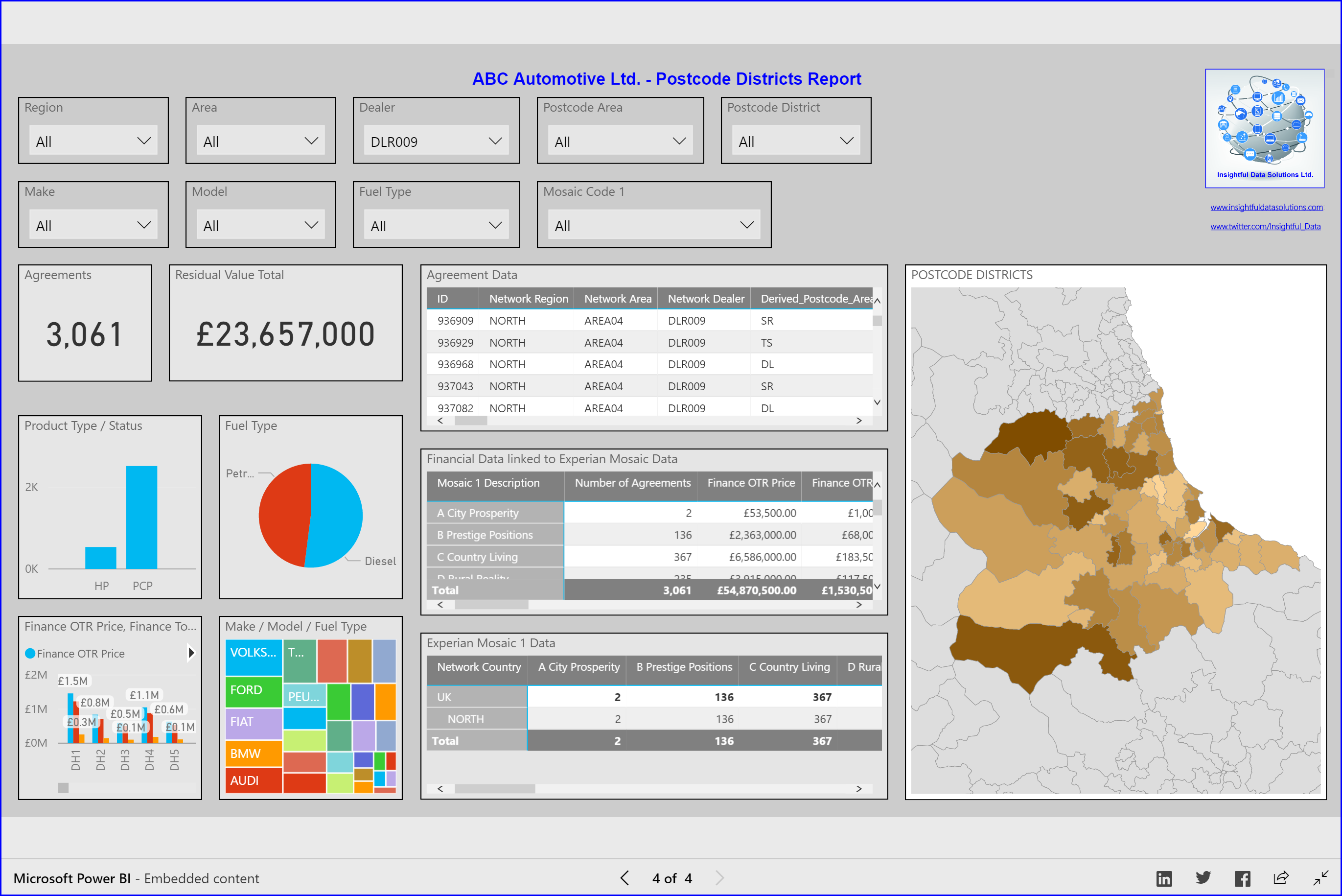
Image 8: A Postcode District report containing a number of different visualisations including a map showing, in this particular report, the relative number of agreements for the Royal Mail Postcode District geographical areas for the selected Network Dealer, “DLR009”.
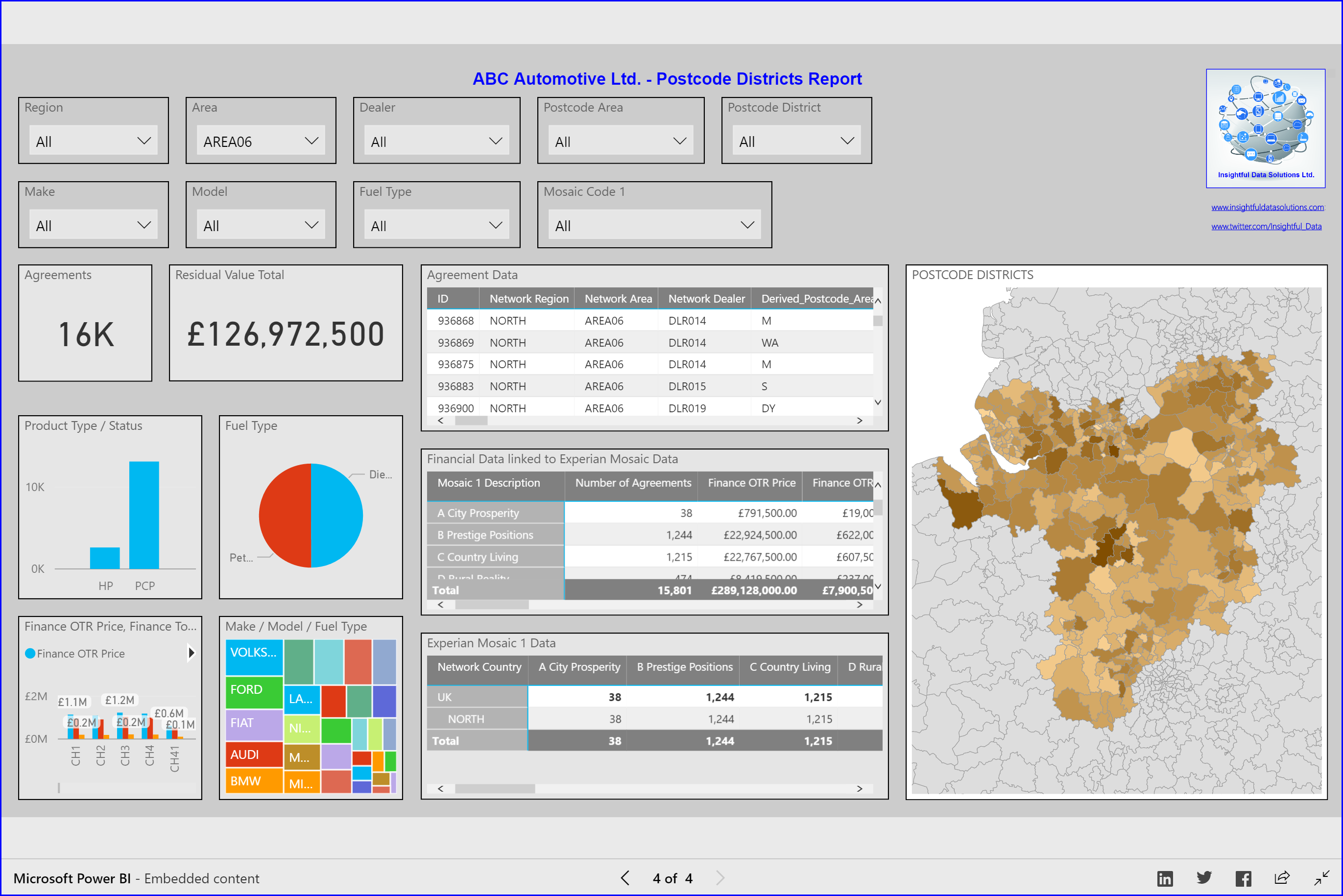
Image 9: A Postcode District report containing a number of different visualisations including a map showing, in this particular report, the relative number of agreements for the Royal Mail Postcode District geographical areas for the selected Network Area, “AREA06”.
Here’s hoping that this was of interest. If you have any questions feel free to contact me at fred.williams@insightfuldatasolutions.com